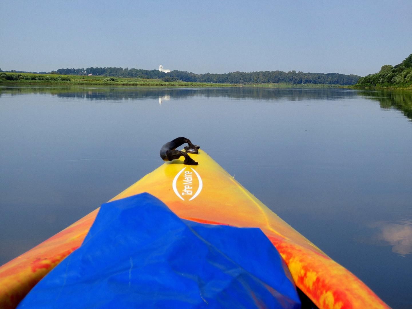
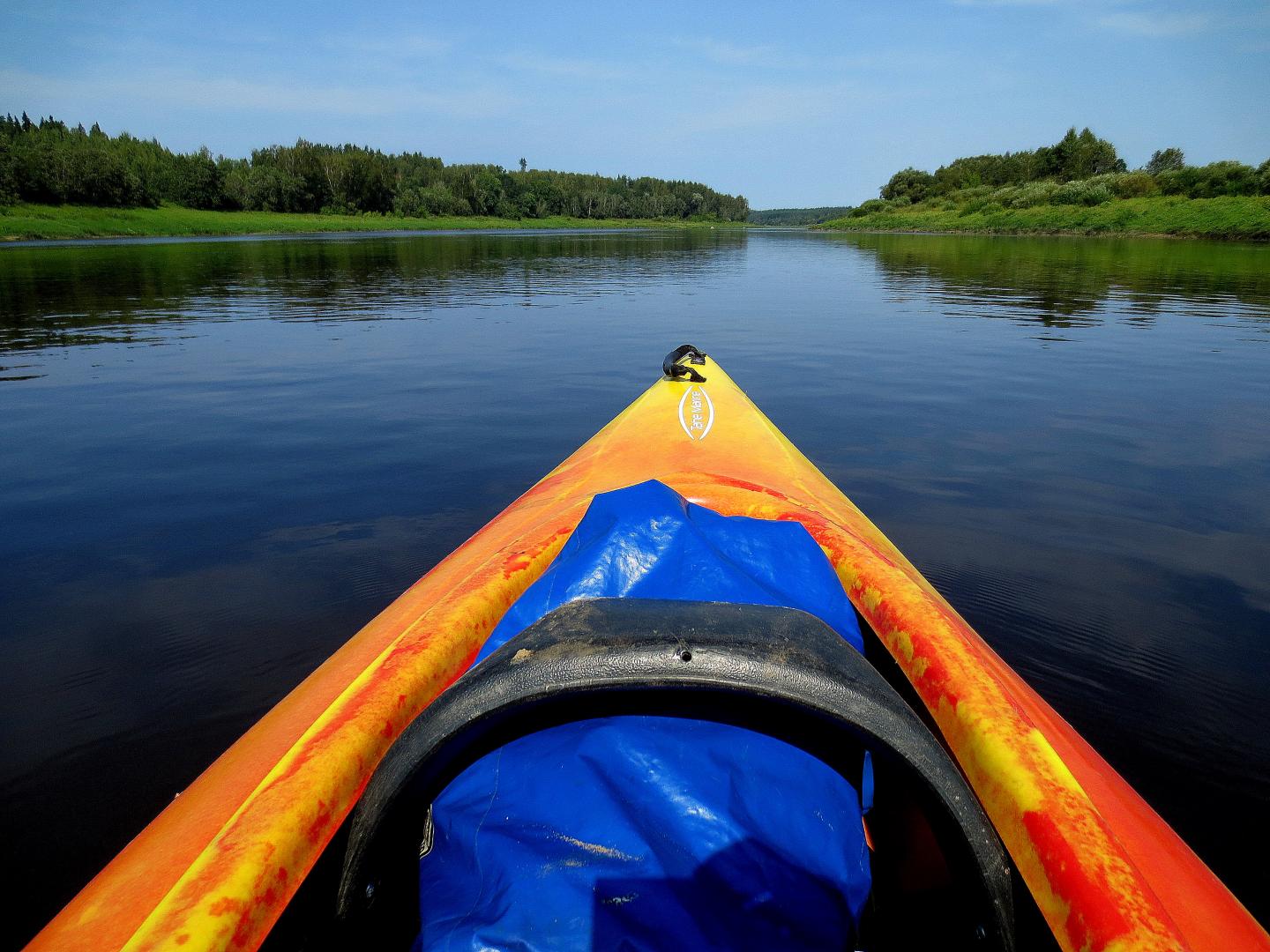
Route: Suitable for active boaters who are interested in longer boat trips for one or two days, during which you can gt to know interesting and less known natural, cultural and historical monuments. Taking into account the fact that at the beginning of the Daugava route – the first 16 km is the border river of Latvia and Belarus, and that’s why several formalities must be completed before setting off (see below). When driving the mentioned section, you must stay closer to the right (Latvia) bank of the river and you must not cross the middle line of the river!! It should be noted thet the island before Piedruja is located on the territory of Belarus. During strong winds, strong waves can be observed in the Daugava, so it’s not suitable for beginners who have no boating experienc, or it’s negligible. Before or after the trip, it’s worth visiting those tourist attractins that are located on the bank of Daugava, but are not visible from the boats point of view, or are located further from the river.
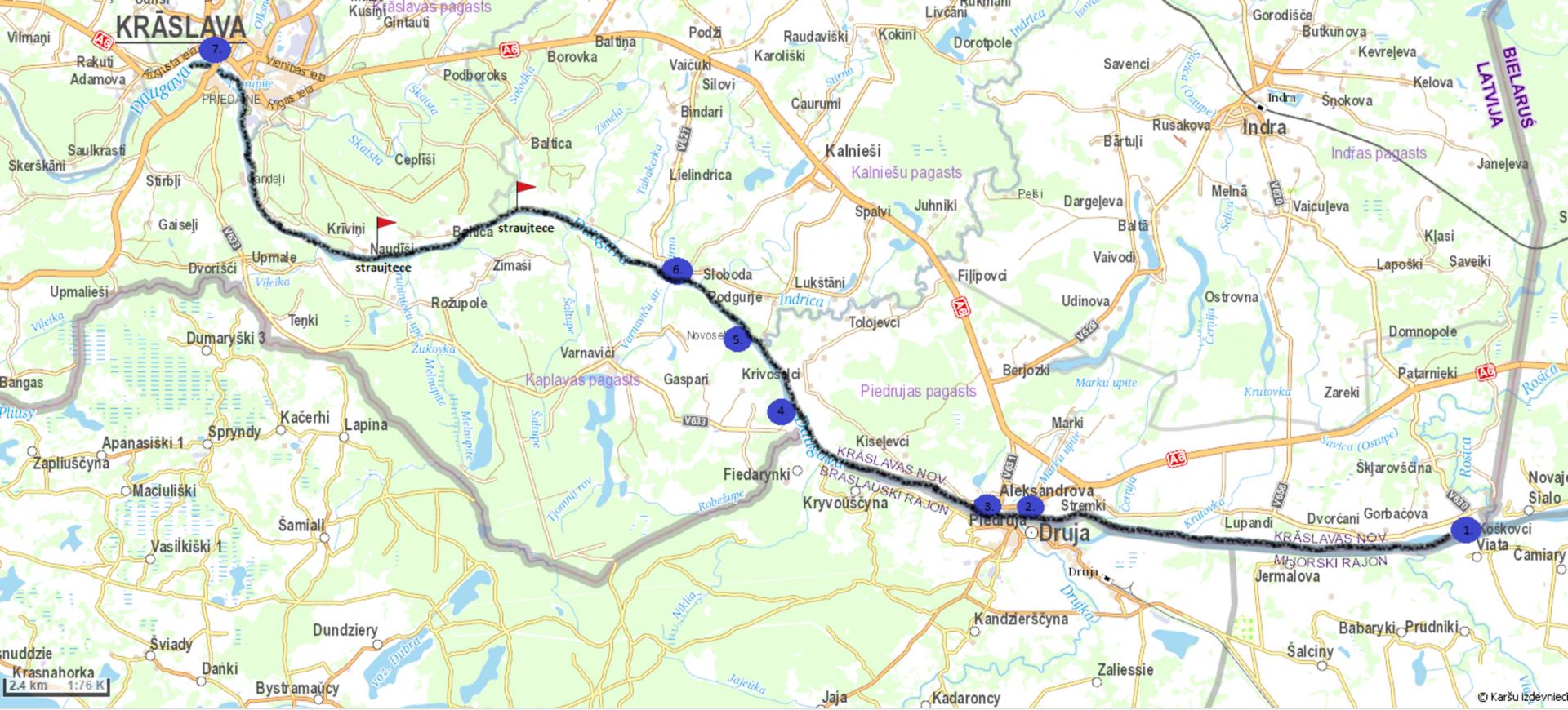
The course of the route: Koskovici- Piedruja- Kraslava- Slutiski. 95% of the routes lenght falls within Kraslava county.
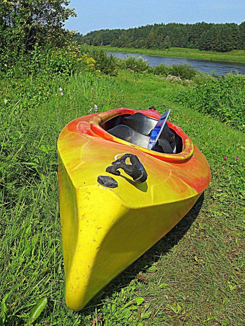
Type of boat. a canoe or kayak type boat is preferred, which are faster and easier to maneuver. The route can also be traveled by dinghy or raft, but they will be more difficult (and slower) to travel in headwinds. The route can also be done in a larger rowing boat.
Recommended time: June- August. Depending on weather conditions, the route can also be driven at other times.Lenght: ~ 63 km. The route can be extended to Krauja (+25 km) or Daugavpils (+37 km). Then you have to count on a three day route.
Time: Two day route if using canoe or dinghy. Day 1: Koskovci- guest house Arkadia (33 km). Day 2: Kraslava- Slutiski (30 km). The time spent on the route may depend on the time devoted to viewing the objects, the type of boat, the number of passengers in the boat, their physical condition, wind direction and strenght water level, current speed, etc. The trip with a rubber boat will take more time, but it largely depends on the factors mentiones above, and most of all- the direstion and strenght of wind.
Degree of difficulty: Easy (in suitable weather condition- no wind or headwind up to 3 m/s) if it’s run as a two day route.
Starting point: Koskovci. ~130m before the turn of the V656 road in the NNW direction, a grassy road leads to Daugava- a path thet can be used to reach the river (0.4 km). It should be taken into account thet ~ 0.3 km in the E direction the river already flows through the territory of Belarus in it’s entire width. It’s strictly forbidden to cross the border by boat!!
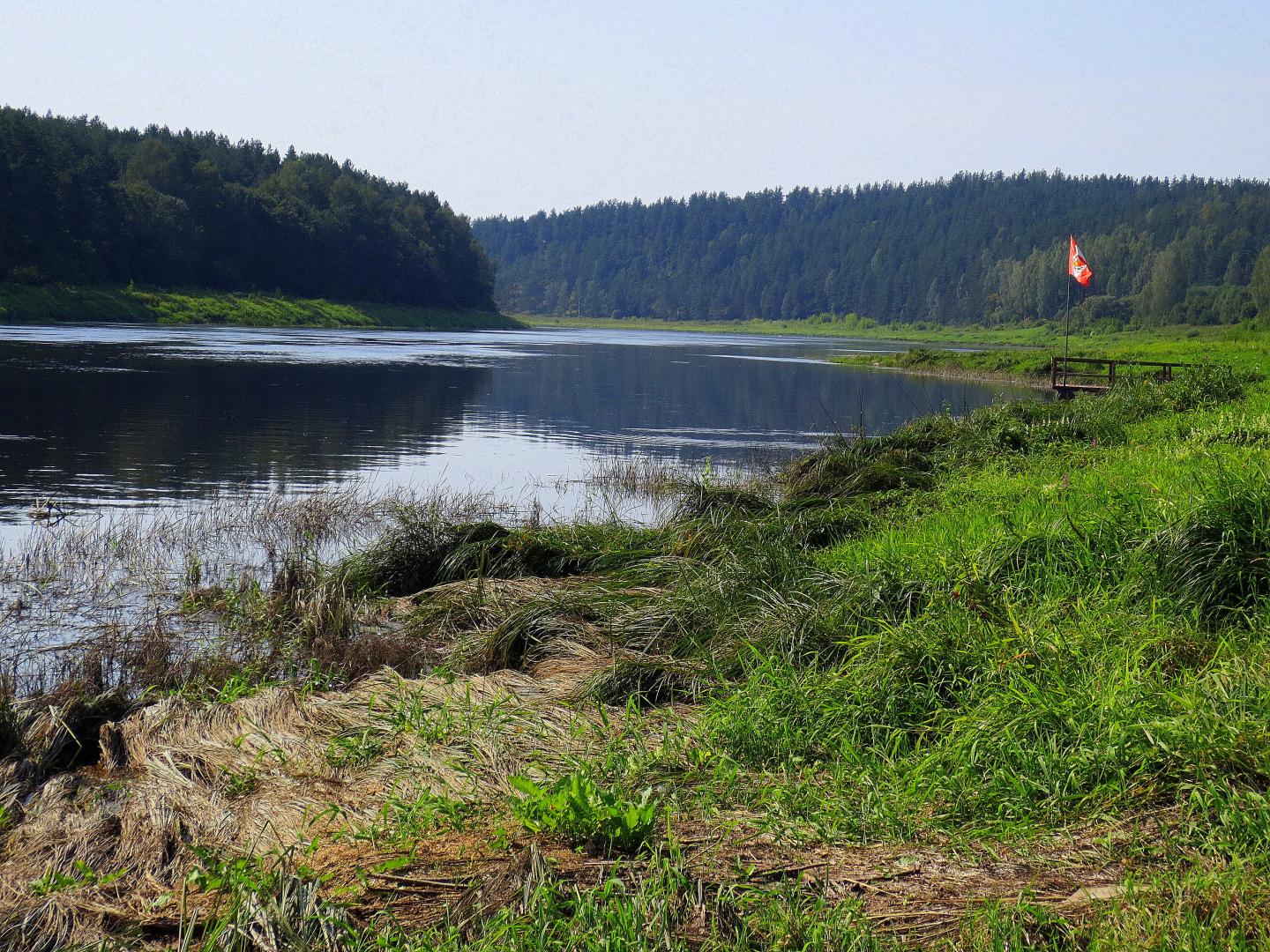
Finish point: Slutiski. Boathouse. There is a dirt road close to the pier, where you can drive up and collect boats for further transportation.
Logistics and public transport: The starting and final point cannot be reached by public transport, so boat transport must be arranged with your own transport or use the services provided by local boat renters.
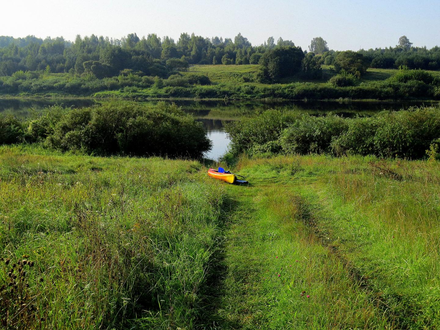
Rest places: It should be taken into account that there are no well equipped water tourism settlements in the mentioned section, as well as publicē rest places on the river bank itself. For short term rest, you can use sandy beaches on the bank of river or islands. Their eksistence and availability is highly dependent on the river, so summer and the time when there have been no significant rains are more suitable.
Information in nature: There are no information stands along the river bank in the mentioned section of the Daugava, therefore maps, information materiāls (it’s convenient to get the Kraslava TIC) and navigation equipment must be prepared before the trip, which must be packed in waterproof covers.
Must know! Safe and responsibel boating!
- Before making the route, make sure of the weather forecast is suitable for boating throught the day, as it is greatly affected by the direction and strenght of the wind in the Daugava;
- If the wind speed exceeds 4-5 m/s, waves form in the Daugava, which can be dangerous for canoes, ect. type pf boats- they can capsize;
- Always wear a life jacket, even when boating close to shore. Daugava can quickly alternates between shallow and deep places;
- Watch out for underwater objects- stones (in rapids), tree fragments, etc. objects, as well as fishing nets;
- Get along with fishermen, try not to scare the fish;
- Evaluate whether this route is suitable for traveling with small children;
- Cross the Daugava only (except where it’s a border river!) if you are an experienced boater and if there is no wind and waves that could endanger safety.
Pay attention! To perform the route (from Koskovci of Piedruja) you need:
- Familiarize yourself with the rules that mut be followed by those who plan to stay in the border regime zone: http://rs.gov.lv/index.php?id=803&top=0 ;
- Before the trip, you must pass the terminated special pass, which is necessary to stay in the boarder regime lane. This can be done easily and quickly electronically on the Latvian state portal www.latvija.lv ;
- On the day of the trip, a visit must be made to the Piedruja border guard department of the Daugavpils administration (located in Piedruja) is required, where you have to register the boat for a trip alonf the Daugava in the section that concides with the border control lane. Tel: +37165403765.
Take care of the safety and health of yourself and your fellow human beings! When making the route, everyone is responsible for their own and others safety! Rescue services: 112.
The route falls whitin two specially protected natural areas (SPNA). Nature park “Daugava loki” was dounded in 1990. the main purpose of it’s creation is the preservation of the unique landscape, biological diversity and cultural and historical monuments of the ancient Daugava Valley. In the eighties of the last century, it was planed to flood the Daugava ancient river in connection with the construction od the Daugavpisl HPS (Hydropower Station). “Daugava loki” is a part of a large SPNA – protected landscapes in the area “Augsdaugava”. In both areas, you can safely go hiking, use the publicly created infrastructure (tralis, tower, rest areas), ride a bicycle, boat on the Daugava, watch birds, animals, pick mushrooms, berries, swim in well maintained places.
- Koskovci. The beginning of the route. A settlement is marked on the map, although there is little evidence of a settlement. The section of the gravel road from Piedruja to Koskovcie, which winds through other settlements- Lupandi, Dvorcanii and Gorbachova- is very interesting. In a short distance from the road you can also see the river valley an the river itself.
- Daugava stone. To be found in the southeastern part of Piedruja, on the bank of the Daugava. You can get there by walking along the Piedruja trail. The memorial stone was made by the sculptor Vilnis Titan, carving the name of Daugava in seven languages- Latvian, Livonian, Estonian, Polish, Russian, German and Finnish. If the location of the stone is not known, it can be passed by when driving along the river. Shortly before the Daugava Stone and Piedruja – there is alarge island (0.9 km long and 0.5 km wide) in the Daugava, located in the territory of Belarus. Here we stay clse to the coast of Latvia!!
- Piedruja. The largest settlement in the southeast of Latvia, which is washed from the south by the waters of Daugava, which is at the same time the border berween Latvia and Belarus. Piedruja consists of two parts- Piedruja and Alexandrova- separated by Central Street (road V631). Piedruja was formed on the left bank of Daugava- the territory of the city Druja on the Belarusian side. Both parts in the 17th century were the properties of the Sapehi family, magnates of the Grand Duchy of Lithuania. The low risebulding of Druja with the abandoned church is clearly visible from the coast of Piedruja. City and its surroundings are worth a walk, as the one story wooden buildings in some places resemble views from ethnogtaphic open air museums. Piedruja is tidy, between the two churches- the Roman Catholic Church of the Assumption of the Virgin Marry in Piedruja (1759) and Piedruja St. Nicholas Orthodox Church (1883-1885) a landscaped garden has been created. The Piedruja trail intruduces the mentioned objects and the already mentioned Daugavas stone. In the Alexandrova part, there is a tourist center “Piedruja”, which offers a special tourist producēt- parties in Latgalian, Russian and Belarusian style(with prior reservation). The Piedruja border control post is locates on the bank of the Daugav, on the side of the main street, where one of the Daugava crossing points operated until reatively reacently.
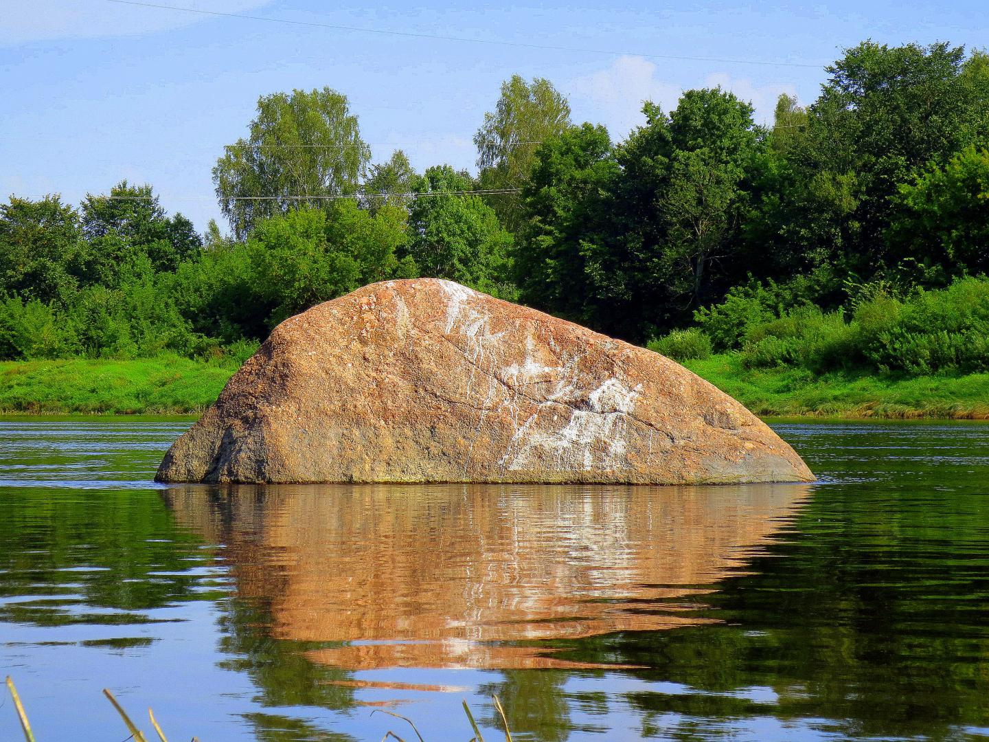
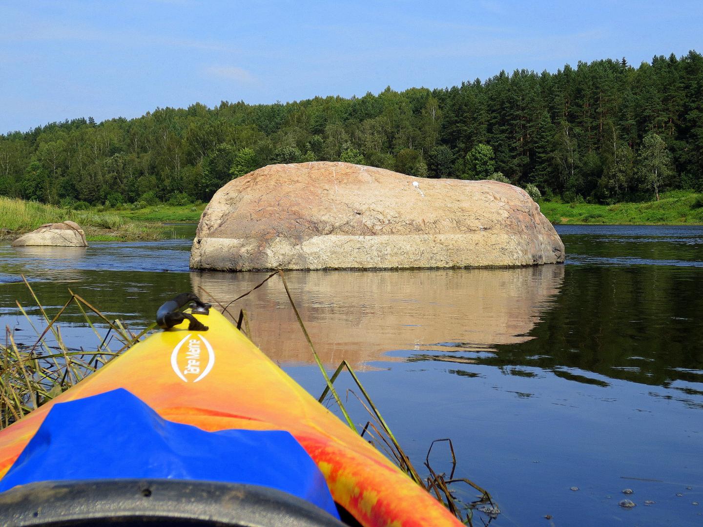
- Robezdaugava(Saulevica, Rudais) stone. It’s located in Daugava, close to the left bank of the river, in front of the houses of Robezdaugava, in a place where Latvian territory is already on both banks of the river. Noticable already in a larger piece! The lenght of the boulder is 4.9 m, hieght 3.3 m, volume ~20m3. Depending on the level of the river, a larger or smaller part of the stone is visible.
- The grat stone of Podgurjes. It’s located below the inlet of Indrica (+-10 min boat ride, visible from the plot) in the water(in dry weather is on sulfur) and close to the left bank of the Daugava. In this place there is a narrowing in the Daugava, a rapid flow on the right side at a lower water level- island. Stone volume about 13m3.
- Indrica Catholic Church. Built from wood by local craftsmen, the church was built between 1655 and 1658 as a miniature one-room basilica at the expense of Count Platers. The one-time monument of cultural history is considered one of the oldest wooden churches in Latgale. The woodcarvings of its central altar in baroque forms were made by the masters of the school of woodcarvers in Stelmuža (today - Lithuania). In the side altar is the 18th century the painting "St. Mary Magdalene". The church was moved to its current location in 1698. The building was restored several times - in 1890 and 1918. A masonry fence built in 17th century stretches around the church. In 19th century a free-standing bell tower was built and was restored in 2002. It is possible that the parish of Indrica is the oldest in Latgale. A house of worship, although surrounded by trees, can also be seen from the boaters' point of view.
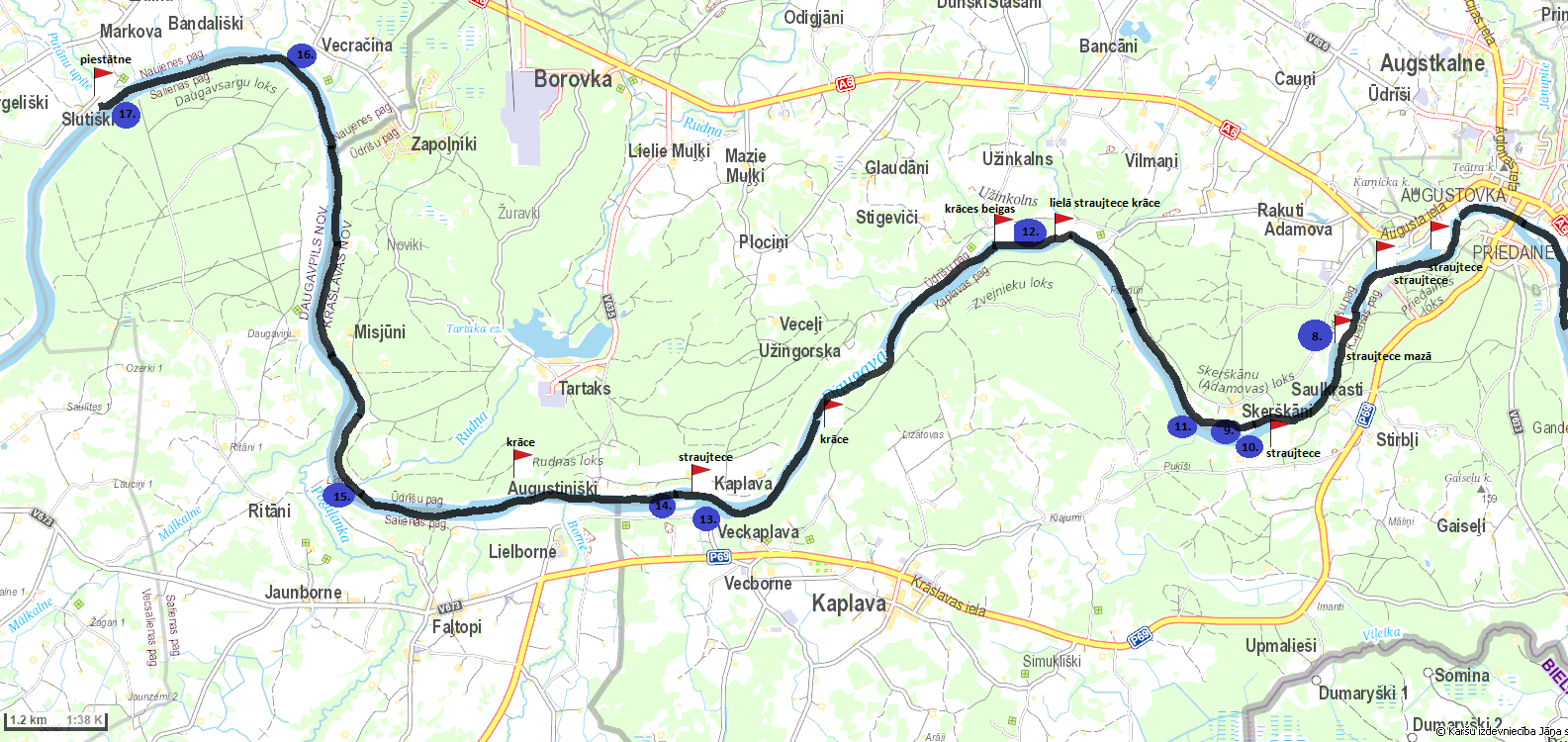
- Kraslava. An ancient settlement of Latgalian people. In the 10th century, the Kraslava region came under the control of the princes of Polotsk, and in the 13th century - the Livonian Order. Until the beginning of the 18th century, it existed as the center of the manor. In 1729, Johannes Ludvig Platers bought Krāslava for 1,400 dalers. The Platers family ruled in Krāslava for two centuries. In the middle of the 18th century, the Platers started the construction of Krāslava Palace. After the first partition of Poland in 1772, Latgali was added to Russia. Kraslava began to decline. After the construction of the Riga - Daugavpils - Vitebsk railway (1865), the economic life of the city flourished again. Krāslava was little affected by the events of the 2nd World War, therefore the wooden construction of the beginning of the 20th century has been preserved little. Krāslava can be recognized from the boat both by the dense buildings and also by the bridge over the Daugava.
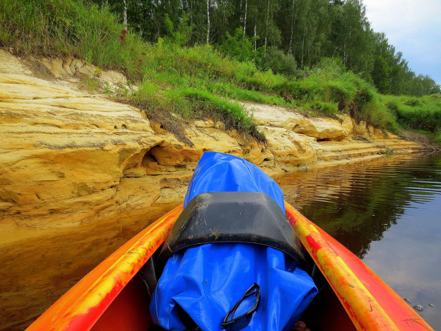
- Adamova precipice. Protected geological monument - one of the longest (about 1.7 km) and highest (25 - 35 m) cliffs of the Daugava. It was formed as a result of lateral erosion, when the waters of the Daugava washed away the main bank of the Daugava in the north of the Adamova arc. In one direction, we go along the top of the Adamova nature trail, in the other - along its foothills. The grandeur of the ancient valley of the Daugava can be felt from the viewpoints and scenic trails at the top of the trail. In the places where the cliff is divided by the deep side gullies, small outcrops can be observed (especially in the leafless period). They contain sediments from the last glaciation. Very small layers of sandstone are exposed (at lower water levels) also near the river itself and are visible from a boat. Active geological processes are taking place in ravines and steep slopes, which is why landslides can be observed in places. They occur in conditions of long-term moisture (rain or spring water, during snowmelt), when separate fragments of slopes slide down. At the foot of the Adamova precipice, you can see the large stone brought from Scandinavia by glacier, the volume of which is 11 m3. In composition, it is a partially metamorphosed coarse-grained hornblende granite. Nearby there is an aspen tree, which consists of five trunks and a big tree, the circumference of which has reached almost four and a half meters. Source can also be viewed. Deciduous forest with old oaks and lindens, large-sized kritalas, dry roots and other elements characteristic of a natural forest, is a protected habitat. Biologists call it /slope forest/. The approximately 1.6 km long Adamova nature trail introduces the Adamova cliff and the natural values in its vicinity. The beginning of the trail can be found at the parking lot, from which a wide view of Kraslava and Daugava Senileja opens. It is most convenient to walk the trail before the boat trip, stopping at the parking lot before Kraslava itself. The trail itself is not visible from the boat!
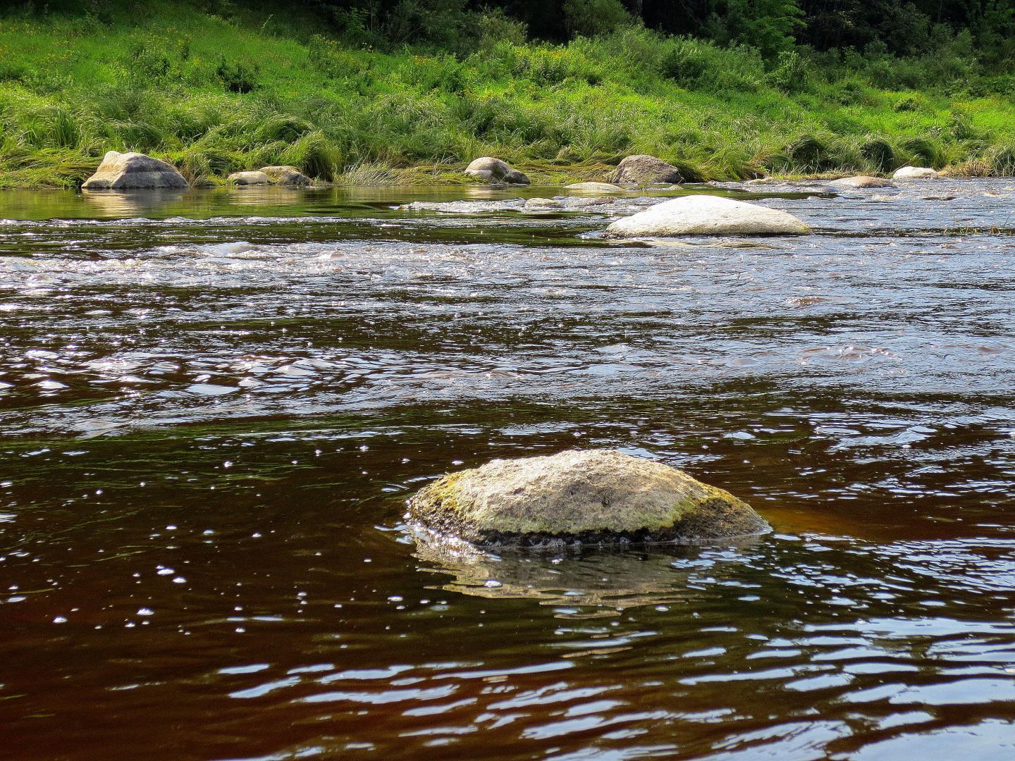
- Skerskani Island. More precisely, a group of islands that appear at a lower water level. The islands were formed when alluvium carried by the river (sand, gravel) was deposited in a place where there are many boulders in the river, which change the speed and direction of the current. In the vicinity, depending on the water level, - rapids and rapids. We go around the left bank side!
- Sprogi avotcirk ravines is the only geological monument of its kind (protected) in the territory of the nature park. It is located in the southern part of Skerskani (Adamova) circle. On the 1.5 km long and up to 35 m high slope of the left bank of the Daugava (in a 70-450 m wide strip), a collection of deep erosion gullies and active springs has formed, hidden in the green foliage of slope forests (protected habitats). In some places, spring cirques are visible - bowl-shaped downgrades on the slopes of rivers or hills, formed by spring waters as a result of washing away rocks or glacial sediments. Sprogy ravines "open" best in the leafless period. From the boat, only the densely vegetated main bank of the Daugava can be seen, and the uninitiated will most likely pass this object by!
- Aizvejini mound. relief formed by the Daugava and its side ravines, the seclusion of the place, as well as the opportunity to have a good view of the river in both directions. There were some of the reasons why one of the ancient places of human life - Aizvejini mound - was formed here. It is located in a less accessible place - on the left main bank of the Daugava between two deep river ditches, ~ 4.5 km downstream of Kraslava - Skerskani (Adamova) in the southern part of the arc. The height of the mound above the nearest neighborhood is 35 m, the area is 70 x 55 m. A 0.9 m thick cultural layer with fragments of polished pottery was discovered in it. Pilskalns was inhabited from the 1st century BCE. to the 1st century CE the middle. Aizvejini mound is an archaeological monument of national importance. If there is a desire to see the object in nature, then a good landmark is the Skerskani house, which offers tourist accommodation, etc. services (placed signs). It is difficult for the uninitiated to distinguish the Aizvejini mound from the general Daugava main bank.
- Uzingora sandstone outcrop. It can be found in the northwestern part of the Fishermen's Circle, on the right bank of the Daugava between Uzhinkalna and Uzhingorsk. The length and height of the outcrop depends on the water level in the Daugava. About 350 mln. age-old Devonian sandstone layers (~ 1.5 m high) colored brown by iron compounds.
- Veckaplava is a small village on the left bank of the Daugava, in Kaplava parish of Krāslava county, between Kaplava and Lielborn. In the 17th century, its inhabitants died during the plague. The place did not remain empty, so Belarusians settled here. In 1810, there were 16 residential houses in the town, there was a parish administration, a court, a prison, a church, a synagogue, three shops and a tavern. At the beginning of the 20th century, an important means of transport was the so-called Dinaburg steamer. In 1932, Kaplava was given the status of a village. After the Second World War, a new center was established 2 km to the east - the so-called Prauliņi, who were later renamed Kaplava, but old Kaplava got the name Veckaplava. Today, Veckaplava is a quiet place with a few houses. The group of fishermen-farmers' farmsteads of Veckaplava is an architectural monument of local importance. The largest building is the Orthodox Church of the Asylum of the Holy Mother of God in Kaplava. The Orthodox congregation in Kaplava was founded in 1794. The first church was small and "poor", so in 1894-1895 the construction of the new church, which is now visible, was started for donations. 1998 a nanny colony of night bats Myotis dasycneme was discovered in the church. A beautiful view of Veckaplava opens from the top of the left main bank of the Daugava, where the road leading into the village crosses it. A good landscape can also be seen from the opposite - right bank of the river and from the boaters' point of view. Opposite Veckaplava on the right bank of the Daugava (Augustiniski) there is a group of homesteads of rafters and fishermen, which is an architectural monument of local importance. Its buildings are in poor condition. It is possible that the oldest could have survived from the 19th century. They are harder to see from the boat.
- Kaplava island. Located in front of Kaplava. In this section of the route – one of the largest islands below Kraslava. There are boulders in the river and rapids in the vicinity of the island.
- Kocini island. It’s located between the house of Kocini and the inlet of the river Rudna.Near the island is a rapid named “Olsanik”.
- Vecracina mound. It’s located in the northeastern part of the Daugavasargi circle, on the right bank of the Daugava. It’s thought to have been inhabited in the late Iron Age. The flat was partially destroyed by arranging an Old Believers cementery from the boat, the mound is difficult to recognize on the common river bank.
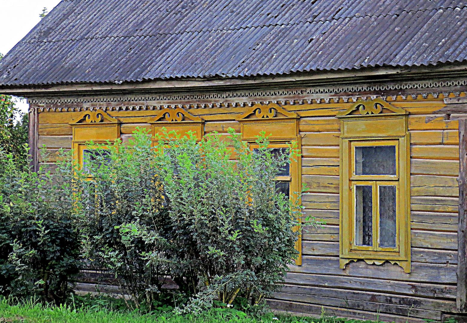
- In the place of Slutiški Old Believers' small settlement in 15th-17th centuries there was a cemetery and a settlement. In the course of archaeological excavations, antiquities of Lithuanian origin were found here. In the second half of the 17th century, Russian Old Believers came to Latvia, escaping from religious persecution in their ethnic homeland. They did not know about the existence of the settlement, so they built their houses on the ancient graves. Today, Slutiški has a small settlement type layout with buildings characteristic of the Latgale region with decorated windows, decorated doors and openwork facades. A museum has been established in Slutiski house of Old Believers (a branch of the Naujenes Regional History Museum), where you can get to know the cultural environment and traditions of Old Believers. Here you should listen to the narration of the museum guide. One of the most unusual cultural landscapes of Latvia opens up from the upper part of the foothills of the Daugava valley. Slutiski cliff can be seen in the south direction from it. There is a pier for water tourists in Slutiski. Slutiski settlement is connected with the Markova mound by the 2 km long Markova trail. Here is the destination of the route!